

St. Louis is a city of neighborhoods, and it has more of them than almost anyone expects. The city officially recognizes 79 of them inside a footprint of about 62 square miles.
79 is a lot for a city this size, and they are not administrative lines that nobody uses. Each one has its own character and its own thing it is known for, whether that is a block party, a parade, an art walk or a farmers market. People here identify by neighborhood in a way they do not in most cities.
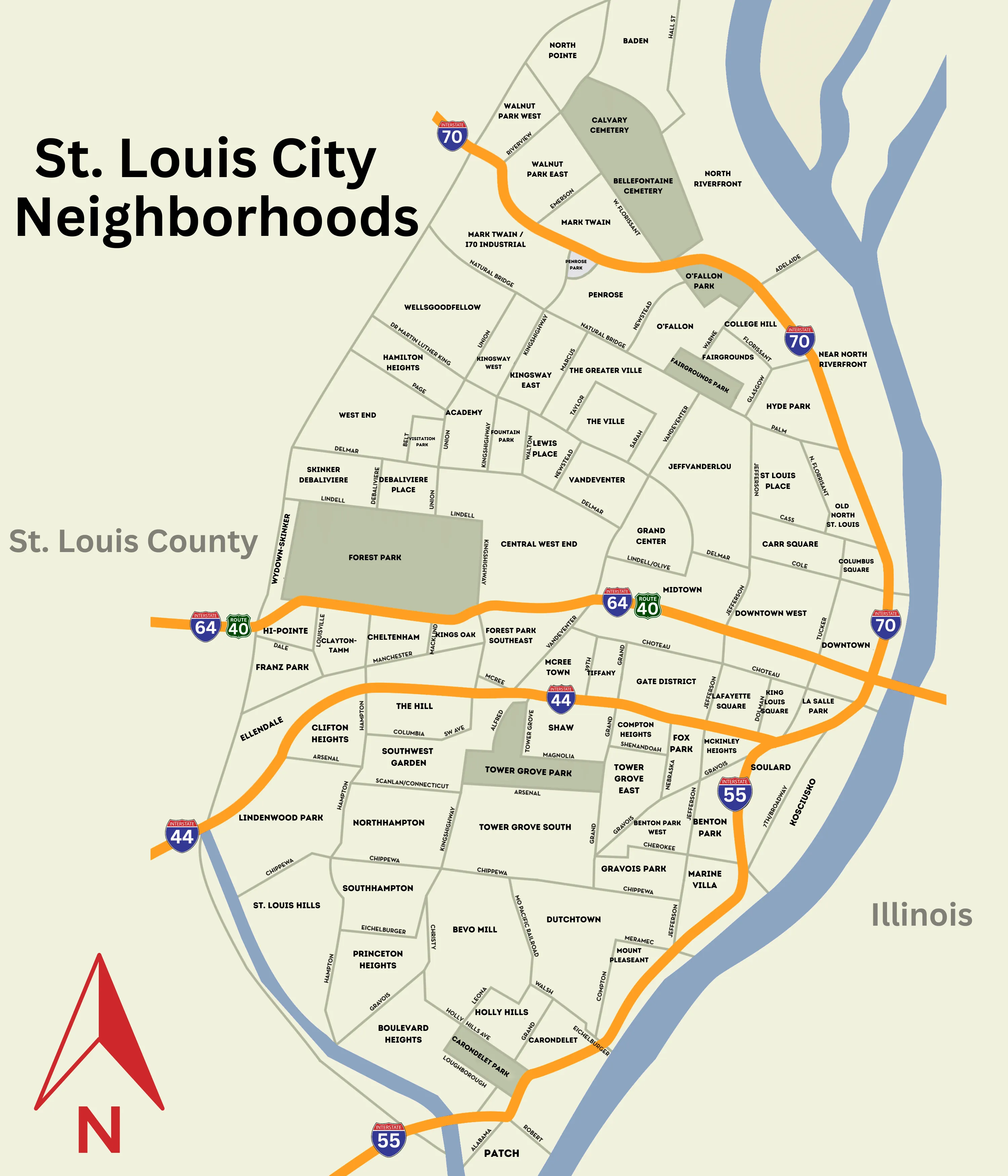
Here is the whole city, with every neighborhood labeled. Click it to open it full size and zoom in.
All 79 St. Louis Neighborhoods
This is the same map of St. Louis neighborhoods in list form, alphabetically, straight from the city's own register. Where we have written a full guide to a neighborhood, its name links to it.
- Academy
- Baden
- Benton Park
- Benton Park West
- Bevo Mill
- Botanical Heights (McRee Town)
- Boulevard Heights
- Carondelet
- Carr Square
- Central West End
- Cheltenham
- Clayton-Tamm (Dogtown)
- Clifton Heights
- College Hill
- Columbus Square
- Compton Heights
- Covenant Blu / Grand Center
- DeBaliviere Place
- Downtown
- Downtown West
- Dutchtown
- Ellendale
- Fairground
- Forest Park Southeast (The Grove)
- Fountain Park
- Fox Park
- Franz Park
- Gravois Park
- Hamilton Heights
- Hi-Pointe
- Holly Hills
- Hyde Park
- JeffVanderLou
- Kings Oak
- Kingsway East
- Kingsway West
- Kosciusko
- Lafayette Square
- LaSalle Park
- Lewis Place
- Lindenwood Park
- Marine Villa
- Mark Twain
- Mark Twain / I-70 Industrial
- McKinley Heights
- Midtown
- Mount Pleasant
- Near North Riverfront
- North Hampton
- North Pointe
- North Riverfront
- O'Fallon
- Old North St. Louis
- Patch
- Peabody-Darst-Webbe
- Penrose
- Princeton Heights
- Riverview
- Shaw
- Skinker-DeBaliviere
- Soulard
- Southampton
- Southwest Garden
- St. Louis Hills
- St. Louis Place
- The Gate District
- The Greater Ville
- The Hill
- The Ville
- Tiffany
- Tower Grove East
- Tower Grove South
- Vandeventer
- Visitation Park
- Walnut Park East
- Walnut Park West
- Wells-Goodfellow
- West End
- Wydown-Skinker
Source: City of St. Louis, Neighborhoods. Read 2026-08-26.
How to Read This Map
A few things worth knowing before you start looking for a specific street.
The city is not part of any county. St. Louis City separated from St. Louis County in 1876 and has been an independent city ever since. That is why the map shows a county line running around it rather than through it, and it is the single most common point of confusion for people moving here. When somebody says they live in St. Louis, they may mean the city on this map or they may mean the metro area around it.
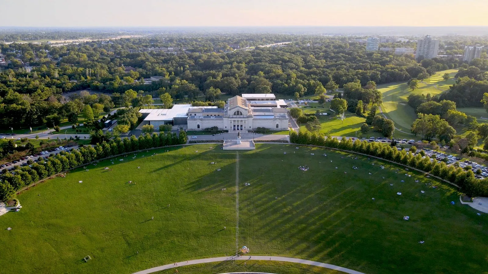
Forest Park is the landmark everything gets described against. At roughly 1,300 acres it is larger than Central Park, it sits toward the western edge of the city, and it holds the Zoo, the Art Museum, the History Museum and the Science Center. If someone tells you a neighborhood is near the park, this is the park they mean.
Neighborhood names are used loosely in conversation. Dogtown is the clearest example: people use it for an area that actually covers several official neighborhoods, Clayton-Tamm among them. The Grove is the business district of Forest Park Southeast rather than a neighborhood in its own right, and Botanical Heights is the current name for what the city still lists as McRee Town in some records. The map shows official boundaries; conversation does not always follow them.
The highways do a lot of the orienting. I-64, which everyone here calls Highway 40, runs east to west through the middle. I-44 runs southwest, I-70 runs north, and I-55 runs south along the river.
Between those four and the river, most of the city is easy to place once you have looked at it a couple of times.
The I-64 corridor is the region’s main east-west artery, and it does not stop at the city limits. Most of the region’s big institutions sit along it: the downtown business district, Union Station, Saint Louis University in Midtown, the Barnes-Jewish and Washington University medical campuses in the Central West End, then Forest Park, and then it carries straight on past the city line into Clayton, which is the county seat. That is worth knowing precisely because a map of the city cannot show it. Plenty of people who work along that corridor live on the far side of a boundary this map draws.
Trying to Work Out Which Part of Town Fits You?
Neighborhoods We Work In Most
We do not have equal knowledge of all 79, and it would be dishonest to pretend otherwise. These ten are the ones we are in regularly, so they are the ones we can describe from experience rather than from a data sheet. They are in alphabetical order, not order of preference.
Benton Park
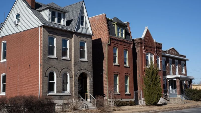
Benton Park is quieter than the neighborhoods around it while still being firmly in the city. It sits between Soulard and Tower Grove, close enough to downtown that the commute barely registers.
The neighborhood is built around its namesake park, and restaurants and cafes are scattered through the residential streets rather than concentrated on one strip. The Lemp Mansion and the old Lemp Brewery complex sit on its edge.
Botanical Heights
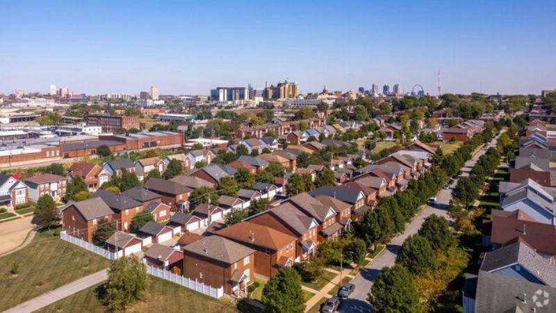
Botanical Heights is small, and it has changed more than any other neighborhood on this page. Built in the early 1900s and known then as McRee Town, it went through decades of decline before the Garden District Commission began redevelopment work north of the Missouri Botanical Garden.
By 2004 six blocks had been rebuilt by McBride and Son, adding 143 single-family homes originally sold between $155,000 and $400,000. City Garden Montessori School anchors the neighborhood, and a handful of restaurants and a patisserie sit along the main street.
Central West End
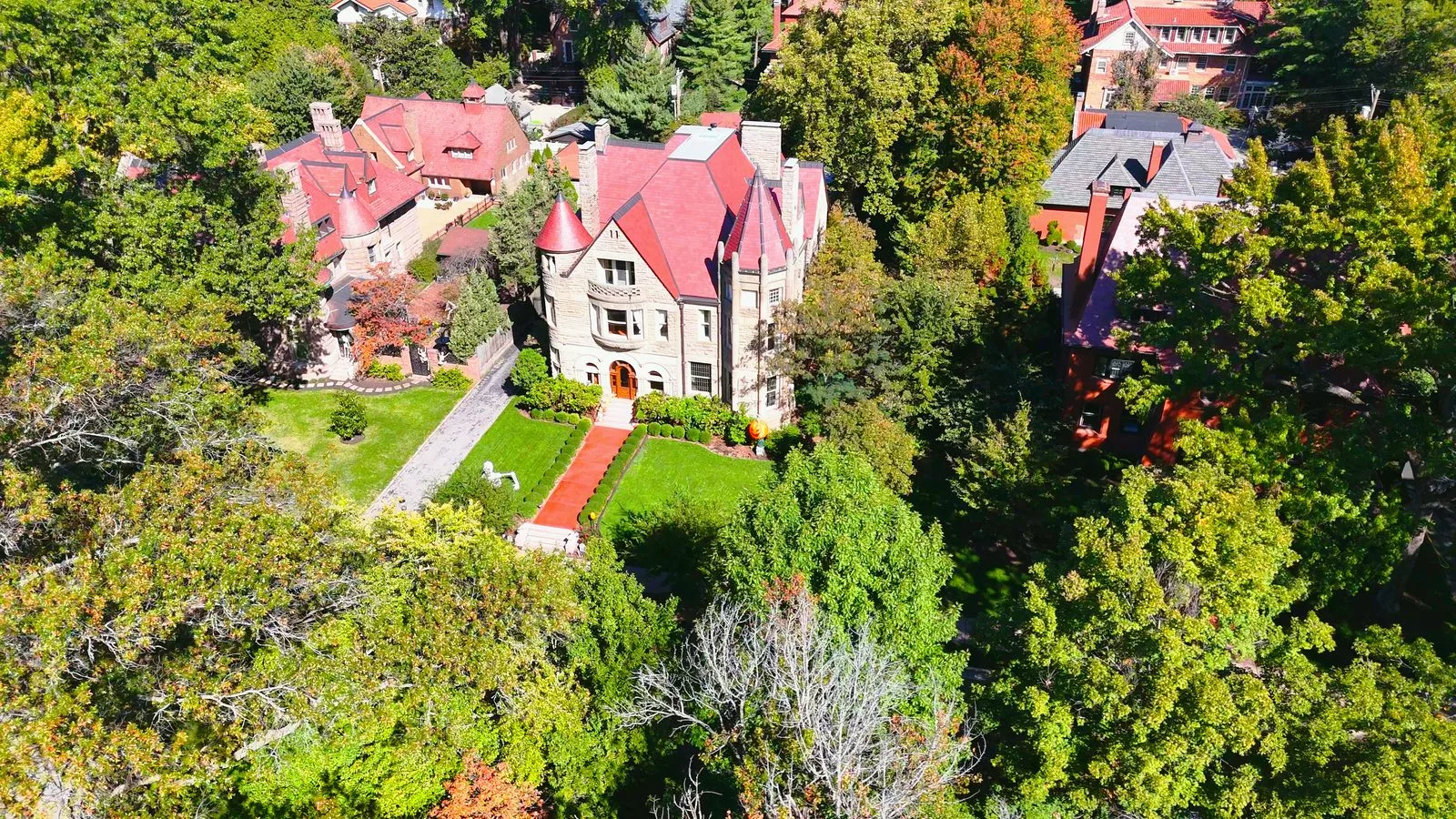
The Central West End runs along the eastern edge of Forest Park and is the densest walkable neighborhood in the city. Euclid Avenue carries the restaurants, bars and shops; the residential streets behind it hold everything from high-rise condos to the private places, gated streets of turn-of-the-century mansions that are maintained by the residents rather than the city.
Barnes-Jewish Hospital and the Washington University School of Medicine sit on its southern edge, which is why so many of the people who live here walk to work.
 11 minutes, 32 seconds
 Living St. Louis
The Grove
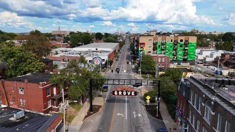
The Grove is the business district of the Forest Park Southeast neighborhood, anchored on Manchester Avenue. It is the center of the city's LGBTQ nightlife, with bars, music venues, galleries and restaurants along a few walkable blocks, and it hosts a stretch of the city's festival calendar.
The area has seen sustained construction over the past decade, so the housing runs from renovated 19th-century brick to new apartment and townhome buildings along the corridor. Both universities are a short drive away.
 7 minutes, 5 secondsLiving St. Louis
The Hill
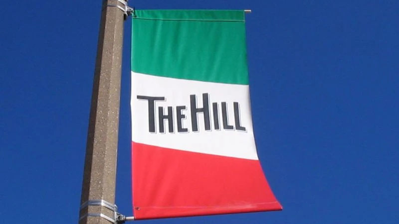
The Hill is the city's Italian-American neighborhood and its best known food destination. Gioia's Deli, Amighetti's and Volpi Foods are all here, and the neighborhood has leaned into that identity deliberately.
Away from the restaurants it is quiet and tightly built, mostly small brick homes on narrow lots, with St. Ambrose Church at its center. Yogi Berra and Joe Garagiola grew up across the street from each other here.
Lafayette Square
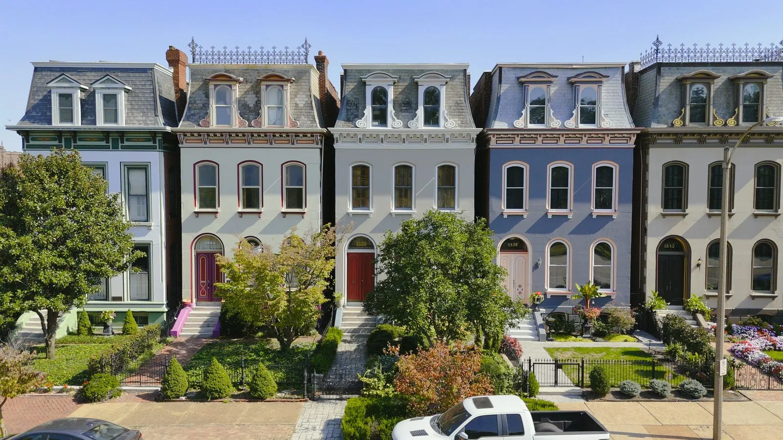
You know you are in Lafayette Square when you see the Painted Ladies, the row of restored Victorian homes overlooking Lafayette Park. The park itself dates to 1836 and is the oldest west of the Mississippi.
The neighborhood was among the most fashionable addresses in the city in the late 1800s, was flattened by the 1896 tornado, and spent most of the 20th century in decline before a restoration movement began in the 1970s. Park Avenue carries the shops and restaurants.
 13 minutes, 34 secondsLiving St. Louis
Shaw
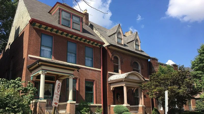
Shaw borders the Missouri Botanical Garden on its eastern edge and takes its name from Henry Shaw, who founded the Garden. Most of the housing was built between 1890 and 1915, which gives the streets an unusually consistent look.
The architecture runs from two-story brick homes to the larger, more decorative houses on Flora Place, a boulevard divided by a landscaped median that residents maintain themselves.
Soulard
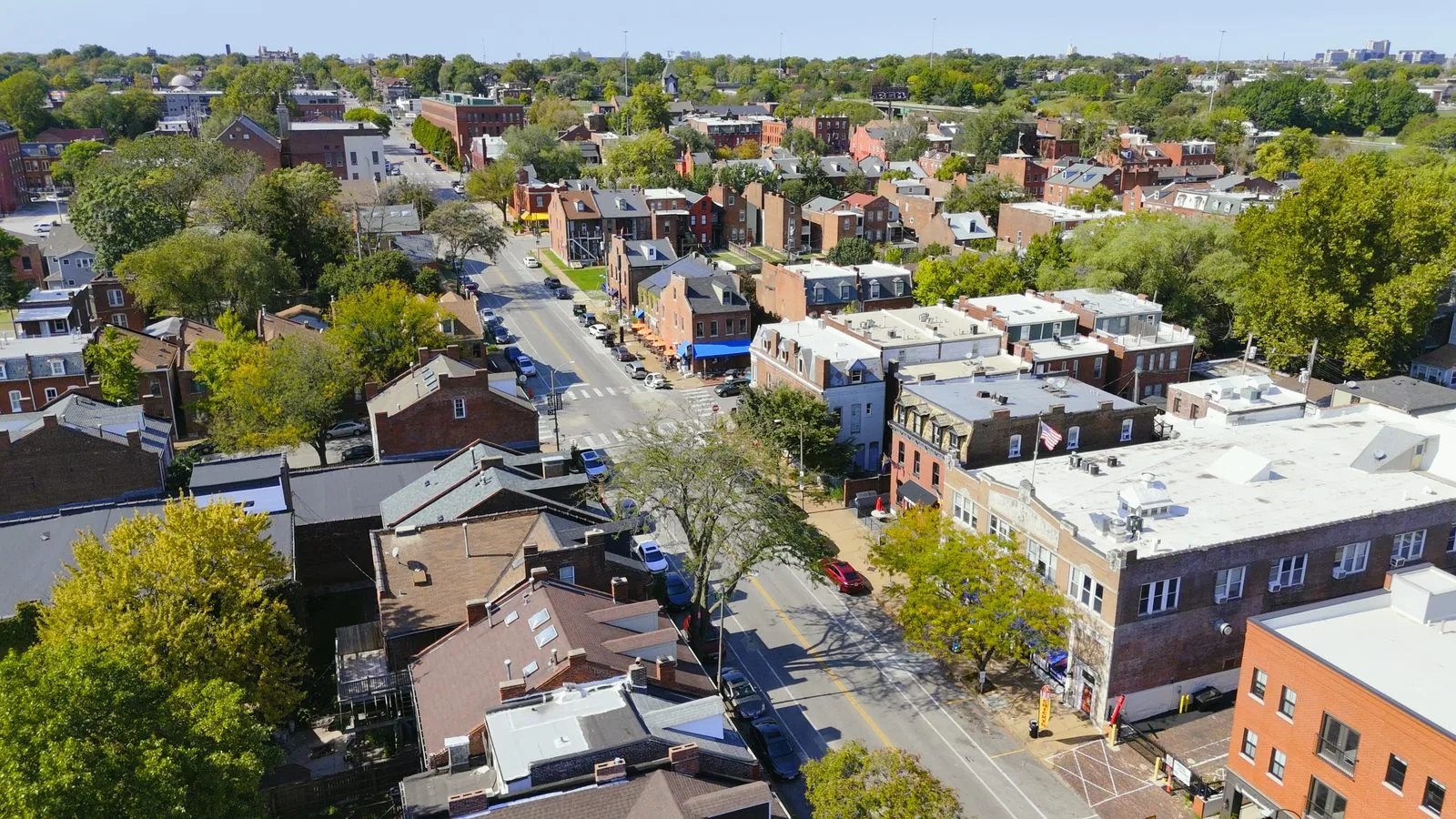
Soulard is the oldest neighborhood in the city, and the most casual of its historic ones. Soulard Farmers Market has operated on the same site since 1779, which makes it the oldest market west of the Mississippi.
The housing is rows of narrow brick homes from the 1800s, and the bar and restaurant density along Russell and Menard is the highest in the city outside downtown. The neighborhood hosts the country's second largest Mardi Gras, which takes it over for a weekend each year.
 10 minutes, 30 secondsLiving St. Louis
St. Louis Hills
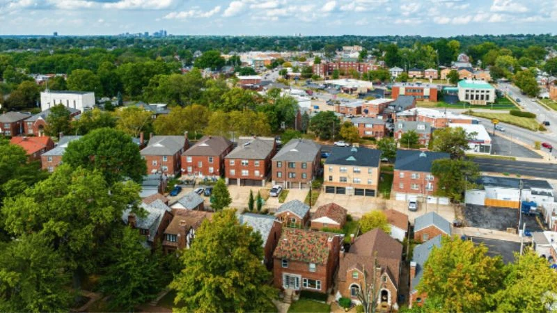
St. Louis Hills, not to be confused with The Hill, sits in the far southwest corner of the city and looks less like the rest of it than anywhere else on this list. It was laid out in the 1930s and 40s, so the streets curve, the lots are wider, and many homes have attached front-entry garages.
Francis Park runs through the middle of it, with a mile-and-a-quarter walking loop that is busy most evenings. Hampton and Chippewa carry the shops and restaurants.
Tower Grove South
Tower Grove South sits along the southern edge of Tower Grove Park, 289 acres of Victorian landscaping that hosts a farmers market every Saturday from spring through fall, plus food truck nights and a run of annual festivals.
South Grand runs along its eastern side and carries one of the densest concentrations of international restaurants in the region. Morgan Ford Road on the western side has its own mix of shops, bars and gyms.
Want to Walk a Few of These Before You Decide?
Maps of the Rest of the Metro
Most people who search for a St. Louis neighborhood map are looking at the city, which is what the map at the top of this page covers. But the metro runs well past the city limits, and a good share of the housing does too. These three cover the rest of it.
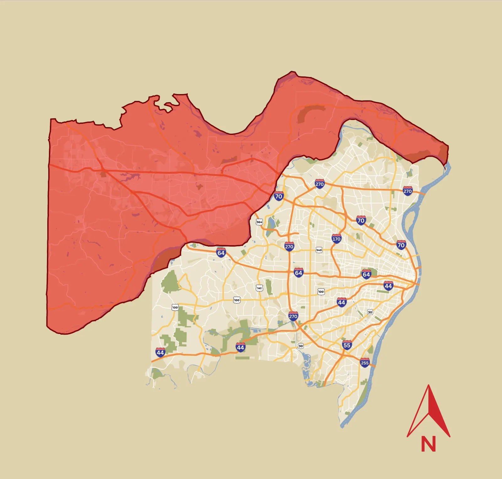
West County runs from the city line out to the Franklin County border, and it is where a lot of the region's newer subdivision housing sits.
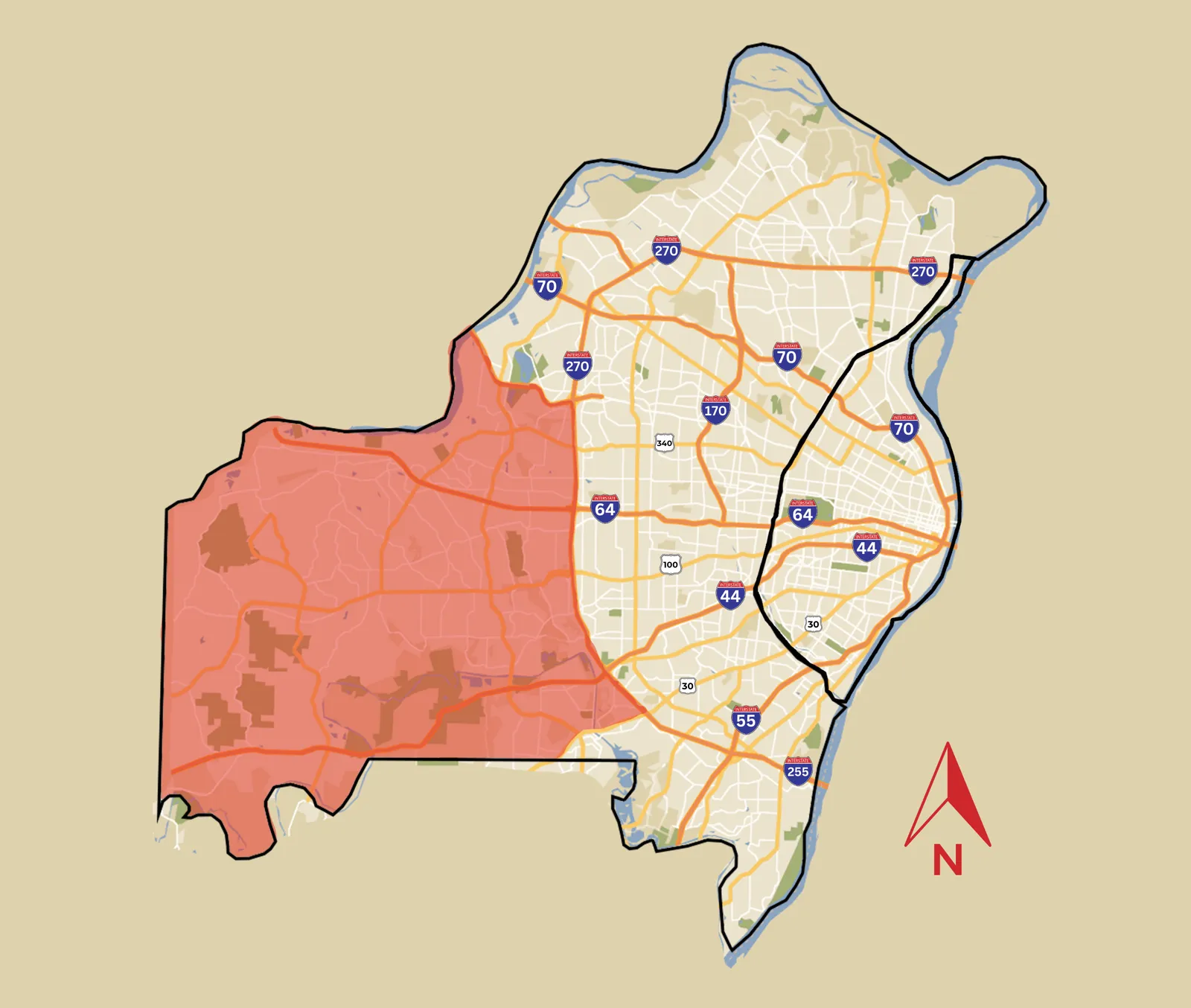
Mid County is the older inner ring, the municipalities that grew up first once people started moving past the city limits. Clayton, the county seat, is in here.
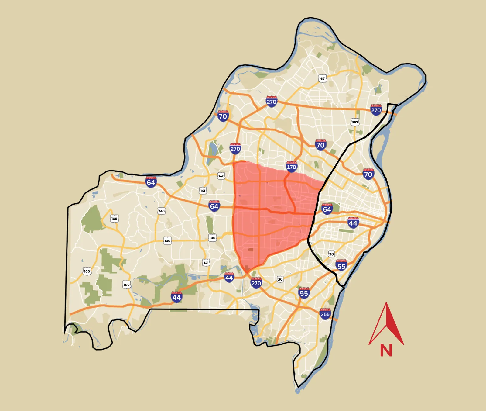
Looking for the wider region rather than the city itself? Our St. Louis neighborhood guide is the place to start, and it covers the metro as a whole.
Each of those has its own hub with the communities inside it: St. Charles County, West St. Louis County and Mid St. Louis County. The city map at the top of this page also appears on our St. Louis City hub, which links out to individual neighborhood guides.
Finding Your Way Around
A map tells you where things are. It cannot tell you what a street feels like on a Tuesday evening, what the parking is actually like, or which block of a neighborhood is different from the block behind it. Those are the things people ask us about, and they are the reason we drive clients around rather than sending them a link.
If you are moving here from out of town, our guide to moving to St. Louis covers the practical side. If you are weighing the city against the suburbs, our roundup of the best suburbs of St. Louis looks at the other direction.
We’re Excited to Work With You!
Someone from our team will reach out within one business day.